
Vai al contenuto
Atlas Anatolia
NotizieIce Age teeth in Sulawesi push betel-nut use back as far as 25,000 yearsRoman mosaic and Eros head uncovered in the basilica at Pompeiopolis, Kastamonu
Pontic rock tombs and Ottoman houses along the Yesilirmak River in Amasya

Wikimedia Commons

CittàIn evidenza

Amasya

Seyfi Cem Baskin

300 a.C. – 1500 d.C.

The royal capital of the Pontic Kingdom, where monumental rock tombs of Pontic kings are carved high into the cliffs above the Yesilirmak River, overlooked by a citadel and flanked by elegant Ottoman mansions.

321
Interesse 54

Posizione

Amasya · Black Sea · Turchia

40.65°N · 35.84°E · Asia

Royal Tombs

5 Pontic rock tombs (3rd-1st century BCE)

Famous Citizen

Strabo, geographer (born c. 64 BCE)

Ottoman Role

Sehzade sancagi — prince training province

Fortress

Pontic-era citadel with rock-cut tunnel

Notable Finds

A 2nd-century BCE marble statue of a Pontic king, discovered near the citadel in 2002.

Dating Method

Stylistic analysis of tomb facades and architectural parallels with other Hellenistic royal tombs.

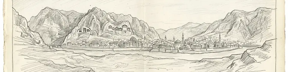
Graphite pencil sketch banner of Amasya

Amasya's rock tombs are among the most impressive royal burial monuments in Anatolia, rivaling Lycian tombs in their dramatic cliff-face settings.”

Da Wikipedia

Amasya is an ancient city in northern Turkey, capital of the Pontic Kingdom, famous for its royal rock tombs carved into cliffs above the Yesilirmak River.

Leggi l'articolo completo su Wikipedia

Posizione

Panoramica

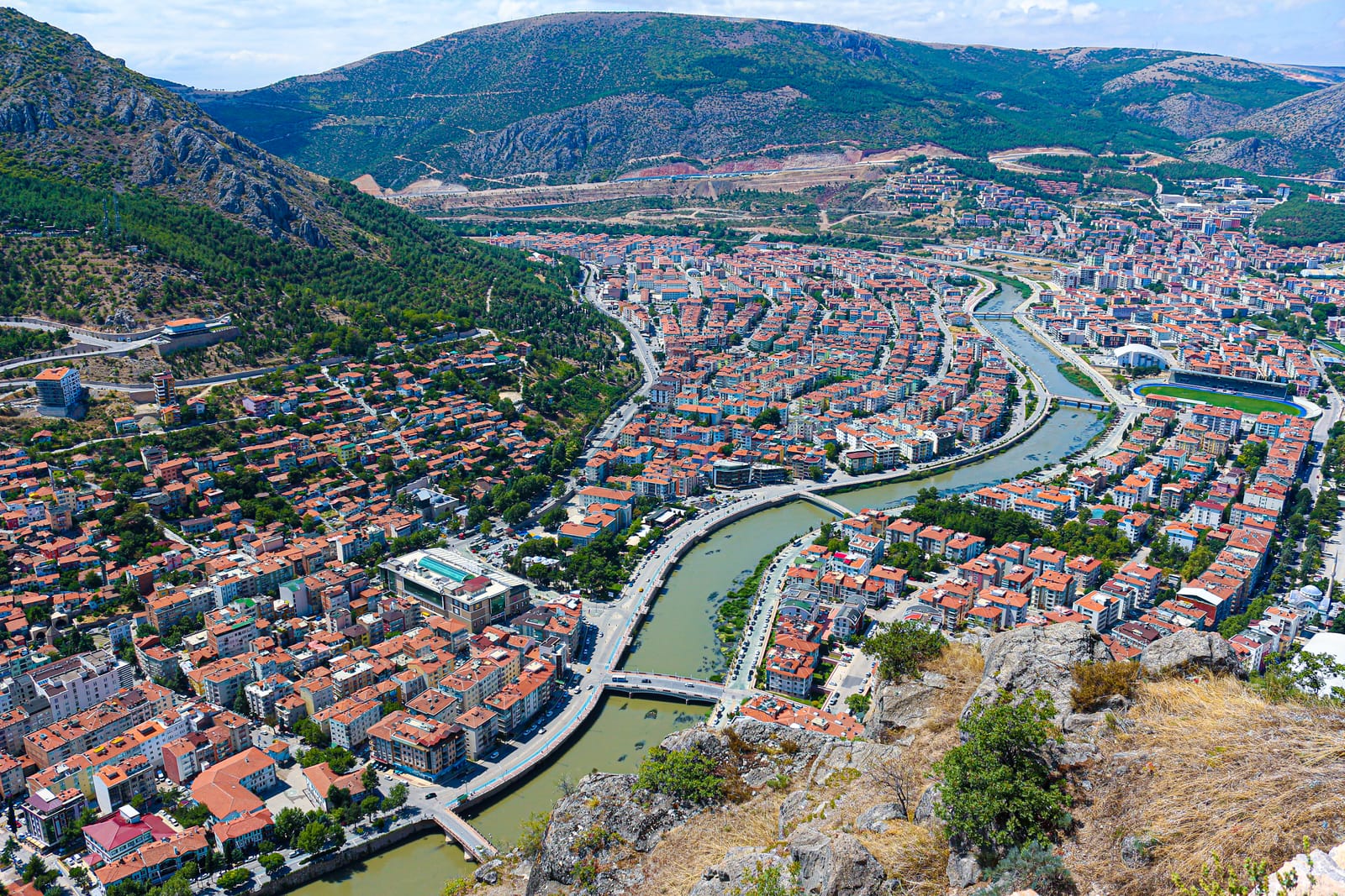
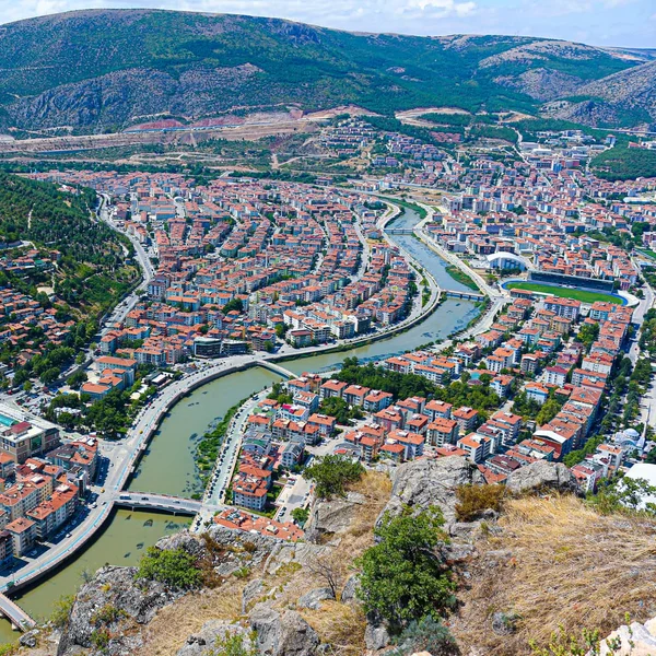
Amasya lies in a narrow valley carved by the Yesilirmak (Iris) River through the mountains of northern Anatolia. The city served as the royal capital and burial place of the kings of Pontus, whose rock-cut tombs — carved directly into the sheer limestone cliffs towering above the river — remain its most dramatic feature. Five monumental royal tombs, dating from the 3rd to 1st centuries BCE, are visible from across the city, their dark rectangular openings a haunting reminder of Pontic royal power.

The city's strategic position at the crossroads of routes linking the Black Sea coast to the Anatolian interior ensured its importance across multiple civilizations. Under Roman rule, Amasya produced the geographer Strabo (born c. 64 BCE), one of the most important writers of the ancient world. The city later became a significant Ottoman center, home to a royal prince's school (sehzade sancagi) where future sultans trained in governance.

"Amaseia, a natural fortress, is the royal seat of the kings, where the tombs of the kings are cut in the rock."
— Strabo, c. 7 BC

Ottoman-era timber mansions (yaliboyu evleri) line the riverbanks, their reflections in the water creating one of Turkey's most photographed urban landscapes. Above the city, a massive Pontic-era fortress crowns the ridge, connected to the river valley by a tunnel carved through rock. The city's historical layers — Pontic tombs, Roman heritage, Seljuk mosques, Ottoman mansions — coexist in a remarkably compact setting.

Beyond the tombs, the city's urban fabric reveals its strategic importance. The Pontic citadel (Harşena Fortress) controlled the valley, while the lower city along the riverbanks was a hub of commerce and daily life. Archaeological finds, including imported pottery and coins, attest to Amasya's integration into wider Hellenistic trade networks across the Black Sea and Anatolia. The city's significance persisted into the Roman and Byzantine periods, serving as a military and administrative center, though its political prominence waned after the fall of the Pontic Kingdom. The later Ottoman period saw a revival, with the construction of the iconic timber-framed mansions (Yalıboyu Evleri) that now line the river, creating the picturesque juxtaposition of ancient, medieval, and early modern architecture that defines the city today.
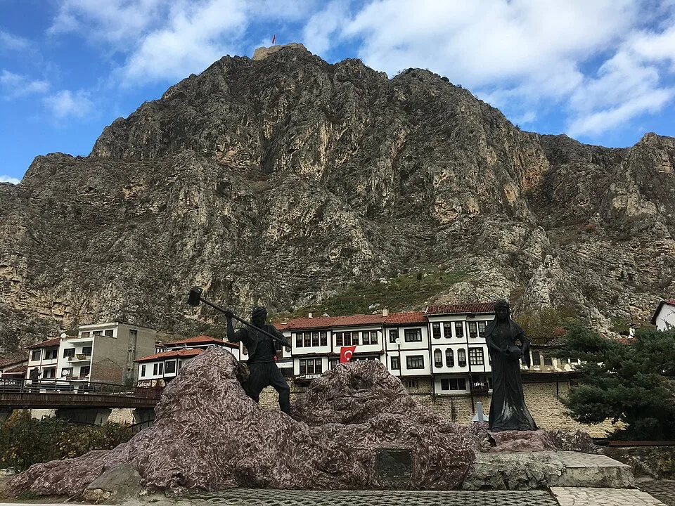
Amasya Dağlarına Karşı
Amasya Dağlarına Karşı | Yiğit Can GÜNÖNÜ (CC BY-SA 4.0)

Perché è importante

Amasya's rock tombs are among the most impressive royal burial monuments in Anatolia, rivaling Lycian tombs in their dramatic cliff-face settings. As the capital of the Pontic Kingdom — a Hellenistic state that challenged Rome's dominance in the eastern Mediterranean — the city represents a chapter of ancient history often overshadowed by better-known kingdoms. The birthplace of Strabo, whose Geography remains one of our primary sources for understanding the ancient world, Amasya holds an outsized place in the history of knowledge. The city's layered heritage from Pontic through Ottoman periods makes it a microcosm of Anatolian civilizational succession.

Evidenze e interpretazione

Distinguere ciò che è ben consolidato da ciò che rimane dibattuto.

Fatti ben consolidati

3
  • Strabo (Geography 12.3.39) identifies Amasya as the capital of the Pontic kings and describes the royal tombs carved into the cliff face.
  • Five monumental rock-cut tombs have been identified as royal Pontic burials based on their scale, location, and parallels with other Hellenistic royal tombs.
  • Inscriptions and literary sources confirm Amasya as the birthplace of the geographer Strabo, born around 64 BCE.

Deduzioni accademiche

2
  • The rock-cut tunnel connecting the citadel to the river may have served as a secret water supply route during sieges, based on similar installations at other Hellenistic fortresses.
  • The large, multi-roomed rock-cut chambers adjacent to the royal tombs were likely used for funerary cult ceremonies and banquets (nekrodeipnon).

Interpretazioni dibattute

1
  • The precise identification of which Pontic king is buried in each tomb remains debated, as the tombs lack conclusive inscriptions.

Scoperta e scavo

1890

Early explorations

Diretto da Georges Perrot

European travelers documented the rock tombs and Pontic fortress, drawing scholarly attention to Amasya's ancient heritage.

2000–2010

Rock tomb conservation

Turkish authorities conducted conservation and stabilization work on the Pontic royal tombs and surrounding cliff face.

2002

Harşena Fortress Excavations

Diretto da Amasya Museum Directorate

Excavations on the citadel (Harşena) uncovered significant Hellenistic and Byzantine fortification walls and a marble statue of a Pontic king.

2015

Citadel excavations

Archaeological survey and limited excavations on the citadel revealed Pontic, Roman, and Byzantine construction phases.

Foto della comunità

Condividi la tua esperienza

Hai visitato questo sito? Carica le tue foto per aiutare gli altri a scoprirlo.

Come citare questa pagina

Atlas Anatolia. (300). Amasya. Atlas Anatolia. https://atlasanatolia.com/it/site/amasya

Contenuto con licenza CC BY-SA 4.0 — è richiesta l'attribuzione in caso di riutilizzo.

Fonti

  • The Kingdom of Pontus and the Roman RepublicBrian McGing (1986)
  • Amasya Rock Tombs: Hellenistic Royal Funerary ArchitectureErgun Lafli (2012)
  • Wikipedia — AmasyaCollegamento

Domande frequenti

Dove si trova Amasya?

Amasya si trova in Amasya, Black Sea, Türkiye.

A quando risale Amasya?

Amasya risale all'incirca al 300 a.C. – 1500 d.C..

Quali civiltà sono associate a Amasya?

Amasya è associato alla civiltà Greek, Roman, Byzantine, Ottoman, Pontic.

Perché Amasya è importante?

Amasya's rock tombs are among the most impressive royal burial monuments in Anatolia, rivaling Lycian tombs in their dramatic cliff-face settings.

Amasya è un sito Patrimonio Mondiale dell'UNESCO?

Amasya non è attualmente iscritto nella lista del Patrimonio Mondiale dell'UNESCO.